REMOTE GEOGRAPHY & GEOLOGY
ISOLATION WITH A HISTORY
Scattered across the frozen margins of the Arctic Ocean are islands whose existence remained unknown to mapmakers until the late nineteenth and early twentieth centuries. These are not desolate wastelands, but complex evolutionary repositories that preserved relics from the Pleistocene epoch.
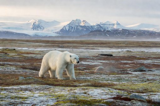
PLEISTOCENE REFUGE
WRANGEL ISLAND: THE LAST MAMMOTH STAND
Situated between the Chukchi Sea and East Siberian Sea at 71° N, Wrangel Island escaped total continental glaciation during the Last Glacial Maximum. While mammoths vanished from the Eurasian mainland roughly 10,000 years ago, an isolated population persisted on Wrangel Island until approximately 2000 BCE (4,000 years ago)—long after the construction of Egypt's Great Pyramid at Giza.
Genetic surveys indicate these island mammoths adapted to reduced food resources before extreme inbreeding and genomic decay finally led to their extinction.
191
Islands in Franz Josef Land Archipelago
2,277 M
Beerenberg Volcanic Peak Elevation (Jan Mayen)
80.5° N
Latitude of Rudolf Island Northern Outpost
1920
Svalbard Treaty Signed in Paris
FOUR REMOTE HIGH-ARCTIC ARCHIPELAGOS
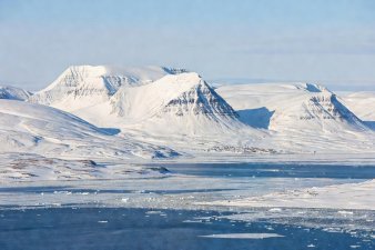 INTERNATIONAL FRONTIER
SVALBARD ARCHIPELAGO
Governed under the international Svalbard Treaty of 1920, this Norwegian territory is home to the world's northernmost permanent civilian settlement (Longyearbyen). Its cold, dry mountain permafrost hosts the Global Seed Vault.
 VOLCANIC & GLACIAL
FRANZ JOSEF LAND
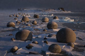
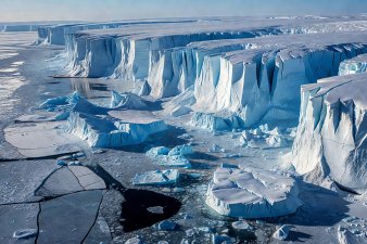
Discovered accidentally by Austro-Hungarian explorers Payer and Weyprecht in 1873, 85% of this 191-island group is smothered under ice domes. On Champ Island, perfect spherical sandstone concretions up to 2 metres across litter the coast.
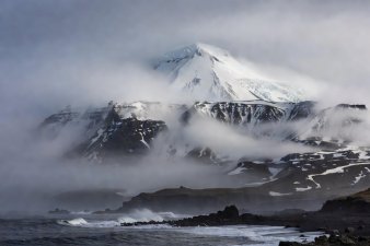 MID-OCEAN RIFT
JAN MAYEN
An isolated volcanic island situated between the Greenland and Norwegian seas, dominated by Beerenberg, an active 2,277 m stratovolcano that erupted as recently as 1985. It supports only a small rotating weather and military detachment.
 THE LAST CHARTED LAND
SEVERNAYA ZEMLYA
Remarkably, this massive archipelago of 37,000 square kilometres was not charted until 1913 by Boris Vilkitsky's hydrographic expedition. It stands as the final major terrestrial landmass added to modern world maps.
THE GEOLOGY OF CHAMP ISLAND'S STONE SPHERES
Among the most visually startling sights on Franz Josef Land are the stone spheres of Champ Island. Ranging from marble-sized pebbles to massive boulders two metres across, these round stones prompted wild speculation when first photographed.
Geological core samples provide a clear natural answer: they are sedimentary concretions formed in Jurassic seabed deposits over 150 million years ago. Mineral cements (primarily calcite and siderite) precipitated symmetrically around organic nuclei—such as shells or plant fragments—gradually growing outward in concentric spherical shells. Millions of years of glacial scouring and subsequent coastal frost-heaving weathered away the softer surrounding mudstone, leaving the durable spheres resting on the tundra.
FIELD NOTE SUMMARY
Arctic islands are natural laboratories of isolation. Untouched by large-scale commercial development, they offer clear records of ancient climates, paleontology, and the unhurried processes of polar rock weathering.
EXAMINE POLAR LIFE ADAPTATIONS